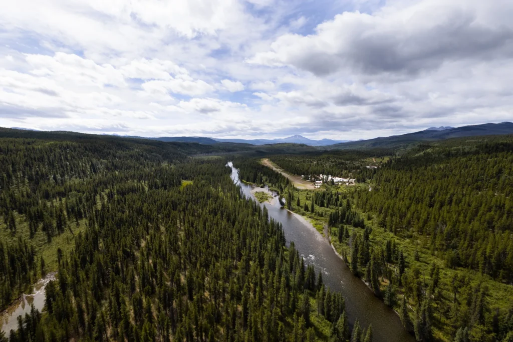
The Turnagain Project is located in north-central British Columbia on the territory of the Tahltan Nation and Kaska Dena. The Turnagain deposit ranks among the largest undeveloped sulfide nickel deposits in the world and includes meaningful quantities of cobalt, platinum and palladium.
The Project is held in Hard Creek Nickel Corporation, a subsidiary jointly owned by Giga Metals Corporation (85%) and Mitsubishi Corporation (15%). Mitsubishi acquired its interest in 2022, and a Pre-Feasibility Study was completed in October 2023.
Turnagain’s ultramafic mineralogy is conducive to mineral carbonation, the natural and permanent sequestration of CO₂ within rock, offering a technically credible pathway to carbon-neutral mine operations. This, combined with proximity to BC’s renewable hydroelectric power, underpins the project’s low-carbon development strategy. As Canada advances its critical minerals agenda, Turnagain is positioned to be a key domestic project in that landscape.
Long-life, large-scale nickel-cobalt operation designed for sustained production.
Average annual nickel and cobalt production during years 3–28.
Net present value based on the September 2023 PFS base-case assumptions.
18% Ni concentrate with 1.1% Co
Turnagain Deposit
Among the world’s largest undeveloped sulfide nickel deposits, the Turnagain deposit is hosted by a large Alaskan-type ultramafic intrusive complex that is also host to meaningful quantities of cobalt and platinum-palladium.
A 2023 PFS outlined the potential for Turnagain to be among the world’s largest nickel projects, envisioning a 30-year project life that would have typical annual nickel output of approximately 37,000 tonnes per annum, in addition to producing cobalt, platinum and palladium.
Turnagain is planned as a conventional open-pit mining operation, with a low strip ratio of approximately 0.4 to 1, feeding a conventional crushing/grinding/flotation processing circuit to produce a high-grade (18% Ni/1.1% Co) nickel/cobalt concentrate saleable to smelters globally.
The project will benefit from access to low-cost, electrical power provided by BC Hydro as well as access to deep water port facilities located at Stewart, British Columbia.
With a significant portion of the Turnagain ultramafic intrusion underexplored and not accounted for in the PFS, the project also offers significant exploration upside with the potential for both increases in known nickel and cobalt resources, as well as new targets of copper and PGE mineralization in previously unexplored areas of the project.
PFS Key Metrics
Resource Estimate (NI 43-101)
The PFS resources released in October 2022 has been updated through revised modeling. The PFS mineral resource is shown below. This resource estimate includes the potentially mineable Horsetrail-Northwest-Duffy and Hatzl zones (north and south of Turnagain River, respectively) and excludes the resources located under the Turnagain River and within an assumed ecological offset boundary. Approximately 95% of the Measured and Indicated Resources lie in the Horsetrail-Northwest-Duffy zones north of the Turnagain River that are the focus of the current mine plan.
Turnagain Nickel-Cobalt Project Mineral Resource Summary1,2,3,4,5
Classification | Tonnage | Ni Grade | Co Grade | Pd Grade | Pt Grade | Contained Ni |
Measured | 454.6 | 0.215 | 0.014 | 0.023 | 0.022 | 1,020 |
Indicated | 1,119.4 | 0.207 | 0.013 | 0.019 | 0.021 | 2,360 |
Measured & Indicated | 1,573.9 | 0.210 | 0.013 | 0.020 | 0.022 | 3,381 |
Inferred | 1,163.8 | 0.206 | 0.012 | 0.016 | 0.018 | 2,405 |
1. All mineral resources have been estimated in accordance with Canadian Institute of Mining and Metallurgy and Petroleum definitions, as required under National Instrument 43-101.
2. Mineral resources are reported in relation to a conceptual pit shell in order to demonstrate reasonable expectation of eventual economic extraction, as required under NI 43-101; mineralisation lying outside of these pit shells is not reported as a mineral resource. Mineral resources are not mineral reserves & do not have demonstrated economic viability.
3. Open pit mineral resources are reported at a cut-off grade of 0.1% Ni. Cut-off grades are based on a nickel price of $9.00 per pound, nickel recoveries of 60%, mineralized material and waste mining costs of $2.80, along with milling, processing and G&A costs of $7.20.
4. Inferred mineral resources are considered too speculative geologically to have economic considerations applied to them that would enable them to be categorised as mineral reserves. However, it is reasonably expected that the majority of inferred mineral resources could be upgraded to indicated.
5. Due to rounding, numbers presented may not add up precisely to the totals provided and percentages may not precisely reflect absolute figures.
Mineral reserves have been determined by Tetra Tech based on development of optimized pits following geotechnical guidance from BGC Engineering. Pit optimization was done using the Lerchs-Grossman optimizer in DatamineTM, with PFS metallurgical recovery algorithms and mining, process, G&A, and concentrate shipping and marketing costs. A sustaining capital allowance was added to ensure that the optimized pit respected the cash flow considerations of regular mining equipment replacement and tailings management construction. An offset was applied to the Turnagain River boundary considering modelled flood scenarios for both environmental preservation and infrastructure integrity.
The ultimate pit was developed from optimization of the net present value for nested cone shells respecting the physical and economic constraints including consideration of pit road widths and angles for the recommended mining equipment.
Internal dilution to the large, disseminated ore body is modeled into the block model. Additional dilution and losses have been considered as a 2-metre loss of ore and 2-metre inclusion of waste at the ore-waste interfaces. An additional 1% mining loss was included to account for ore unmined, spilled, and improperly delivered to waste.
The Proven and Probable Mineral Reserves are given below. The mineral resources in the Hatzl zone have not been included in the mine plan and Reserves.
Turnagain Nickel-Cobalt Project Mineral Reserve Summary1,2,3,4,5,6
Classification | Tonnage | Ni Grade | Co Grade | Pd Grade | Pt Grade | Contained Ni |
Proven | 408.1 | 0.219 | 0.013 | 0.024 | 0.022 | 894 |
Probable | 542.4 | 0.194 | 0.012 | 0.020 | 0.022 | 1,055 |
Total | 950.5 | 0.205 | 0.013 | 0.022 | 0.022 | 1,949 |
Notes:
1. The Mineral Reserve estimates were prepared with reference to the 2014 Canadian Institute of Mining, Metallurgy and Petroleum (CIM) Definition Standards (2014 CIM Definition Standards) and the 2019 CIM Best Practice Guidelines.
2. Reserves estimated assuming open pit mining methods.
3. Reserves are reported on a dry in-situ basis.
4. Reserves are based on a nickel price of US $21,500/t, cobalt price of US $58,500/t, ore mining cost of $2.24/t mined, waste mining cost $2.41/t mined, mining sustaining capital of $0.57/t mined, milling costs of $5.35/t ore feed to process plant, TMF sustaining capital of $0.70/t ore feed, and G&A cost of $0.76/t ore feed.
5. Mineral Reserves are mined tonnes and grade including consideration for a 2-m dilution width between ore-waste contact and 1% mining losses.
6. Ore-waste cut-off was based on $6.63/t of NSR.
Stikine Region, Northern British Columbia
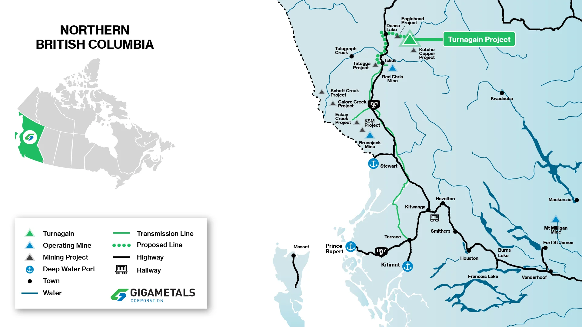
The Turnagain property lies 65 kilometres east of the community of Dease Lake. Dease Lake is located on Highway 37, about 400 kilometres north of the Port of Stewart. An 80 kilometre access trail extending east from Dease Lake leads into the Turnagain property and is used to haul equipment and supplies. A 900-metre-long dirt airstrip accommodates small aircraft. This airstrip is immediately adjacent to the current camp facility.
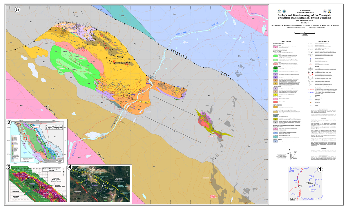
Alaskan-Type Ultramafic Complex
The Turnagain Nickel property covers the known extent of a zoned, Alaskan-type ultramafic intrusive complex in fault contact with Paleozoic to Early Mesozoic graphitic sedimentary rocks along its northern and eastern margins. The southern contact is not exposed, but several drill holes have penetrated the contact and intersected deformed, graphitic phyllites in fault contact with the ultramafic complex.
The Turnagain intrusion comprises a central core of dunite with bounding units of wehrlite, olivine clinopyroxenite, clinopyroxenite, hornblende clinopyroxenite, and hornblendite. The complex is elongate and broadly conformable to the northwesterly-trending regional structural grain.
The ultramafic rocks are generally fresh to mildly serpentinized; however, more intense serpentinization and talc-carbonate alteration are common along faults and restricted zones within the complex. The central part of the ultramafic body is intruded by granodiorite to diorite, and hornblende–plagioclase porphyry dikes and sills.
The sulfide mineralisation, which is unusual for an Alaskan-type intrusion, is thought to be associated with meta-sediment wall-rock inclusions which provided the sulphur source. The sulfides are mainly pentlandite and pyrrhotite with minor amounts of chalcopyrite and pyrite, and trace bornite. Anomalous levels of platinum and palladium are also present; however, they are not considered economic at this time.
Mineralization is unusual for an Alaskan-type intrusion and is associated with meta-sediment wall-rock inclusions — the source of sulfur. The intrusion is generally fresh to mildly serpentinized; intense serpentinization and talc-carbonate alteration occur along faults.
Alaskan-Type Ultramafic Complex
SULFIDE MINERALIZATION
NI 43-101 COMPLIANCE
The above technical information and all the other technical information on this website pertaining to geology and drill hole data has been reviewed and approved by Greg Ross, P. Geo., Giga Metals’ Turnagain Project Manager, and a Qualified Person under NI 43-101. Technical information pertaining to project execution has been reviewed and approved by Lyle Trytten, P.Eng., a Qualified Person under NI43-101.
Turnagain Nickel-Cobalt Project · British Columbia, Canada
Among the largest undeveloped sulfide nickel deposits in the world — located in north-central British Columbia on the traditional territory of the Tahltan and Kaska Dena.